| Cruise Region : Australia / New Zealand |
| Company Category : Premium |
| Company name : Princess Cruises |
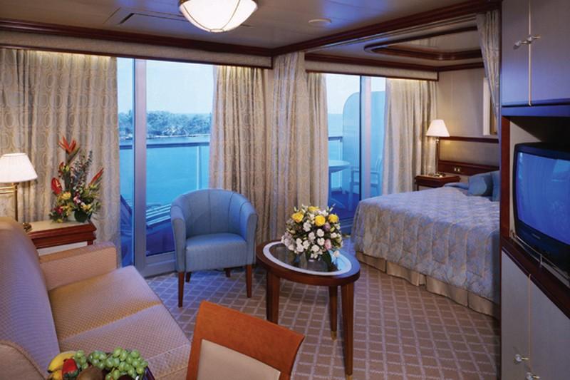
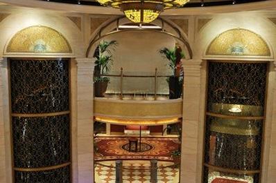
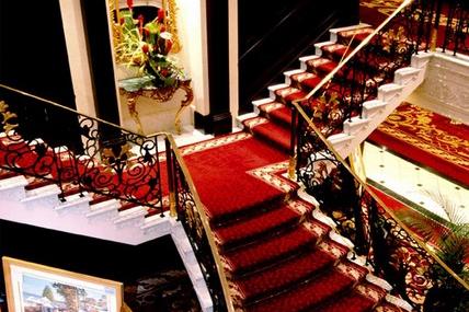
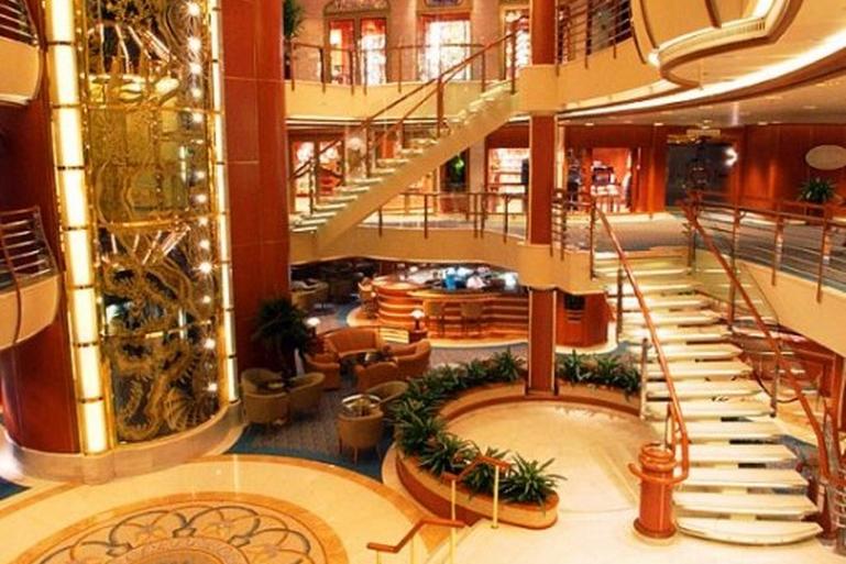
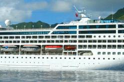
| Ship name : Pacific Princess |
| Journey Start Date : Tue 16 Nov 2021 |
| Journey End Date : Fri 10 Dec 2021 |
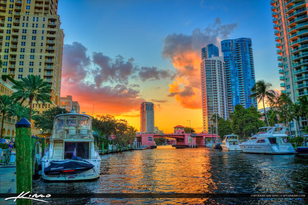
| Port start : Fort Lauderdale / USA |
| Port end : Papeete Papeete / French Polynesia |
| Count Nights : 24 nights |
| Day | Port | Date | Arrival | Departure |
|---|---|---|---|---|
| 1 | Fort Lauderdale / USA | Tue 16 Nov | 16:00 | |
| 2 | Day at sea / Sea | Wed 17 Nov | ||
| 3 | Day at sea / Sea | Thu 18 Nov | ||
| 4 | Aruba (Oranjestad) / Aruba | Fri 19 Nov | 09:00 | 18:00 |
| 5 | Day at sea / Sea | Sat 20 Nov | ||
| 6 | Panama Canal / Panama | Sun 21 Nov | 06:00 | 16:30 |
| 7 | Day at sea / Sea | Mon 22 Nov | ||
| 8 | Day at sea / Sea | Tue 23 Nov | ||
| 9 | Guayaquil / Ecuador | Wed 24 Nov | 05:00 | 18:00 |
| 10 | Day at sea / Sea | Thu 25 Nov | ||
| 11 | Day at sea / Sea | Fri 26 Nov | ||
| 12 | Lima / Peru | Sat 27 Nov | 07:00 | 18:00 |
| 13 | Day at sea / Sea | Sun 28 Nov | ||
| 14 | Day at sea / Sea | Mon 29 Nov | ||
| 15 | Day at sea / Sea | Tue 30 Nov | ||
| 16 | Day at sea / Sea | Wed 01 Dec | ||
| 17 | Day at sea / Sea | Thu 02 Dec | ||
| 18 | About Easter / Chile | Fri 03 Dec | 07:00 | 16:00 |
| 19 | Day at sea / Sea | Sat 04 Dec | ||
| 20 | Day at sea / Sea | Sun 05 Dec | ||
| 21 | Adamstown / Pitcairn Islands | Mon 06 Dec | 08:00 | 11:00 |
| 22 | Day at sea / Sea | Tue 07 Dec | ||
| 23 | Day at sea / Sea | Wed 08 Dec | ||
| 24 | Moorea, Society Islands / French Polynesia | Thu 09 Dec | 08:00 | 17:00 |
| 24 | Papeete Papeete / French Polynesia | Thu 09 Dec | 20:00 | |
| 25 | Papeete Papeete / French Polynesia | Fri 10 Dec |
| Build Year : 1999 |
| Width : 25.00 |
| Length : 181.00 |
| Speed : 18.00 |
| Capacity : 688 |
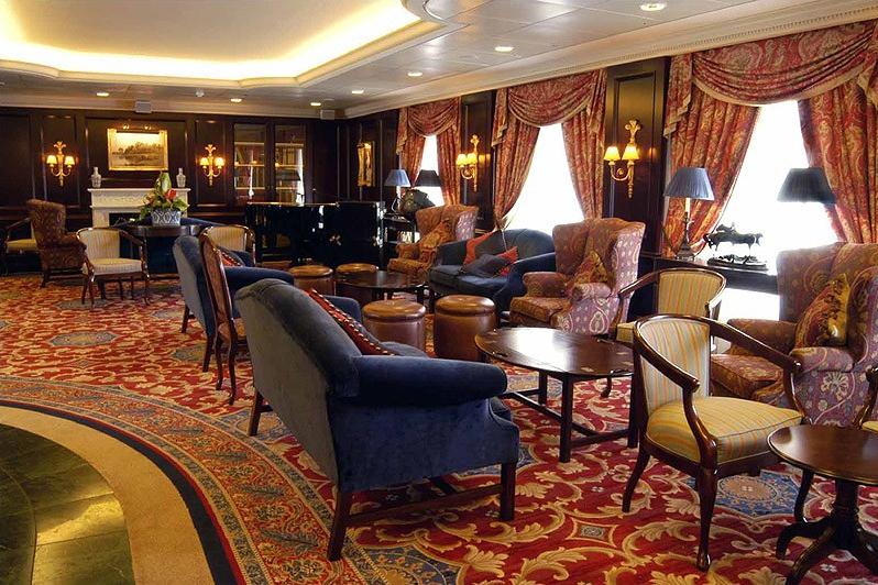
| Deck Quantity : 9 |
| Cabin Quantity : 344 |
| Restaurant Quantity : 3 |
| Lift Quantity : 4 |
| Balancer : Yes |

Fort Lauderdale is a city in the U.S. state of Florida, 28 miles (45 km) north of Miami. It is the county seat of Broward County. As of the 2017 census, the city has an estimated population of 180,072. Fort Lauderdale is a principal city of the Miami metropolitan area, which was home to an estimated 6,158,824 people in 2017.
The city is a popular tourist destination, with an average year-round temperature of 75.5 °F (24.2 °C) and 3,000 hours of sunshine per year. Greater Fort Lauderdale, encompassing all of Broward County, hosted 12 million visitors in 2012, including 2.8 million international visitors. In 2012, the county collected $43.9 million from the 5% hotel tax it charges, after hotels in the area recorded an occupancy rate for the year of 72.7 percent and an average daily rate of $114.48. The district has 561 hotels and motels comprising nearly 35,000 rooms. Forty-six cruise ships sailed from Port Everglades in 2012. Greater Fort Lauderdale has over 4,000 restaurants, 63 golf courses, 12 shopping malls, 16 museums, 132 nightclubs, 278 parkland campsites, and 100 marinas housing 45,000 resident yachts.
Fort Lauderdale is named after a series of forts built by the United States during the Second Seminole War. The forts took their name from Major William Lauderdale (1782–1838), younger brother of Lieutenant Colonel James Lauderdale. William Lauderdale was the commander of the detachment of soldiers who built the first fort. However, development of the city did not begin until 50 years after the forts were abandoned at the end of the conflict.
Three forts named "Fort Lauderdale" were constructed: the first was at the fork of the New River, the second was at Tarpon Bend on the New River between the present-day Colee Hammock and Rio Vista neighborhoods, and the third was near the site of the Bahia Mar Marina.
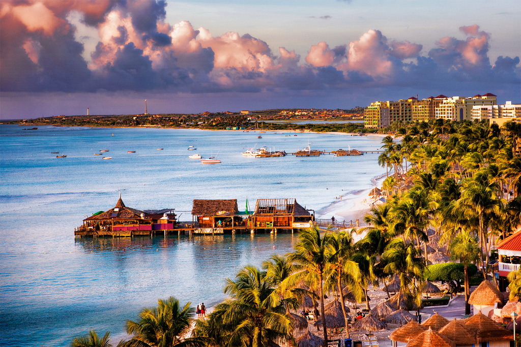
Aruba is an island and a constituent country of the Kingdom of the Netherlands in the southern Caribbean Sea, located about 1,600 kilometres (990 mi) west of the main part of the Lesser Antilles and 29 kilometres (18 mi) north of the coast of Venezuela. It measures 32 kilometres (20 mi) long from its northwestern to its southeastern end and 10 kilometres (6 mi) across at its widest point. Together with Bonaire and Curaçao, Aruba forms a group referred to as the ABC islands. Collectively, Aruba and the other Dutch islands in the Caribbean are often called the Dutch Caribbean.
Aruba is one of the four countries that form the Kingdom of the Netherlands, along with the Netherlands, Curaçao, and Sint Maarten; the citizens of these countries are all Dutch nationals. Aruba has no administrative subdivisions, but, for census purposes, is divided into eight regions. Its capital is Oranjestad.
Unlike much of the Caribbean region, Aruba has a dry climate and an arid, cactus-strewn landscape. This climate has helped tourism as visitors to the island can reliably expect warm, sunny weather. It has a land area of 179 km2(69.1 sq mi) and is densely populated, with a total of 102,484 inhabitants at the 2010 Census. It lies outside Hurricane Alley.
The Panama Canal is an artificial 82 km (51 mi) waterway in Panama that connects the Atlantic Ocean with the Pacific Ocean. The canal cuts across the Isthmus of Panama and is a conduit for maritime trade. Canal locks are at each end to lift ships up to Gatun Lake, an artificial lake created to reduce the amount of excavation work required for the canal, 26 m (85 ft) above sea level, and then lower the ships at the other end. The original locks are 34 m (110 ft) wide. A third, wider lane of locks was constructed between September 2007 and May 2016. The expanded canal began commercial operation on June 26, 2016. The new locks allow transit of larger, post-Panamax ships, capable of handling more cargo.
France began work on the canal in 1881, but stopped due to engineering problems and a high worker mortality rate. The United States took over the project in 1904 and opened the canal on August 15, 1914. One of the largest and most difficult engineering projects ever undertaken, the Panama Canal shortcut greatly reduced the time for ships to travel between the Atlantic and Pacific Oceans, enabling them to avoid the lengthy, hazardous Cape Horn route around the southernmost tip of South America via the Drake Passage or Strait of Magellan.
Colombia, France, and later the United States controlled the territory surrounding the canal during construction. The US continued to control the canal and surrounding Panama Canal Zone until the 1977 Torrijos–Carter Treatiesprovided for handover to Panama. After a period of joint American–Panamanian control, in 1999, the canal was taken over by the Panamanian government. It is now managed and operated by the government-owned Panama Canal Authority.
The city is the capital of Guayas Province and the seat of Guayaquil canton.
Guayaquil is on the west bank of the Guayas River, which flows into the Pacific Ocean at the Gulf of Guayaquil.
Lima is the capital and the largest city of Peru. It is located in the valleys of the Chillón, Rímac and Lurín rivers, in the central coastal part of the country, overlooking the Pacific Ocean. Together with the seaport of Callao, it forms a contiguous urban area known as the Lima Metropolitan Area. With a population of more than 9 million, Lima is the most populous metropolitan area of Peru and the third-largest city in the Americas (as defined by "city proper"), behind São Paulo and Mexico City.
Lima was founded by Spanish conquistador Francisco Pizarro on January 18, 1535, as Ciudad de los Reyes. It became the capital and most important city in the Viceroyalty of Peru. Following the Peruvian War of Independence, it became the capital of the Republic of Peru. Around one-third of the national population lives in the metropolitan area.
The island was formed as a volcano 1.5 to 2.5 million years ago, the result of a Society hotspot in the mantle under the oceanic plate that formed the whole of the Society Archipelago. It is theorized that the current bays were formerly river basins that filled during the Holocene searise.
Mo'orea is about 10 miles in width from the west to the east. There are two small, nearly symmetrical bays on the north shore. The one to the west is called 'Ōpūnohu Bay, which is not very populated but many travelers have come into the bay. The main surrounding communes of the bay are Piha'ena in the east and Papetō'ai to the west. The one to the east is Cook's Bay, also called Pao Pao Bay since the largest commune of Mo'orea is at the bottom of the bay. The other communes are Piha'ena to the west and busy Maharepa to the east. The highest point is Mount Tohi'e'a, near the center of Mo'orea. It dominates the vista from the two bays and can be seen from Tahiti. There are also hiking trails in the mountains. The Vai'are Bay is another small inlet, smaller than the two main bays, on the east shore. This bay has been settled a lot and has a lot of business. The main village is located just south of the bay.
Papeete is the capital city of French Polynesia, an overseas collectivity of France in the Pacific Ocean. The commune of Papeete is located on the island of Tahiti, in the administrative subdivision of the Windward Islands, of which Papeete is the administrative capital. The French High Commissioner also resides in Papeete. It is the primary center of Tahitian and French Polynesian public and private governmental, commercial, industrial and financial services, the hub of French Polynesian tourism and a commonly used port of call. The Windward Islands are themselves part of the Society Islands. The name Papeete means "water from a basket".
The urban area of Papeete had a total population of 136,771 inhabitants at the August 2017 census, 26,926 of whom lived in the commune of Papeete proper.