| Cruise Region : South America / Antarctica |
| Company : Azamara Cruises |
| Ship : Azamara Onward |
| Journey Start : Wed 19 Jan 2028 |
| Journey End : Fri 04 Feb 2028 |
| Count Nights : 16 nights |
| Day | Date | Port | Arrival | Departure |
|---|---|---|---|---|
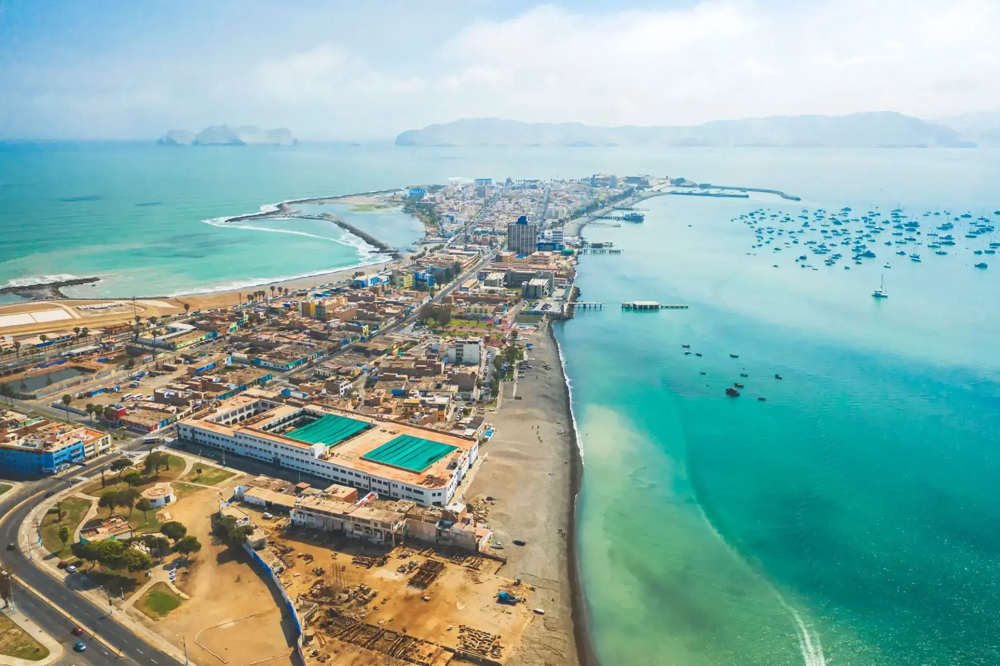
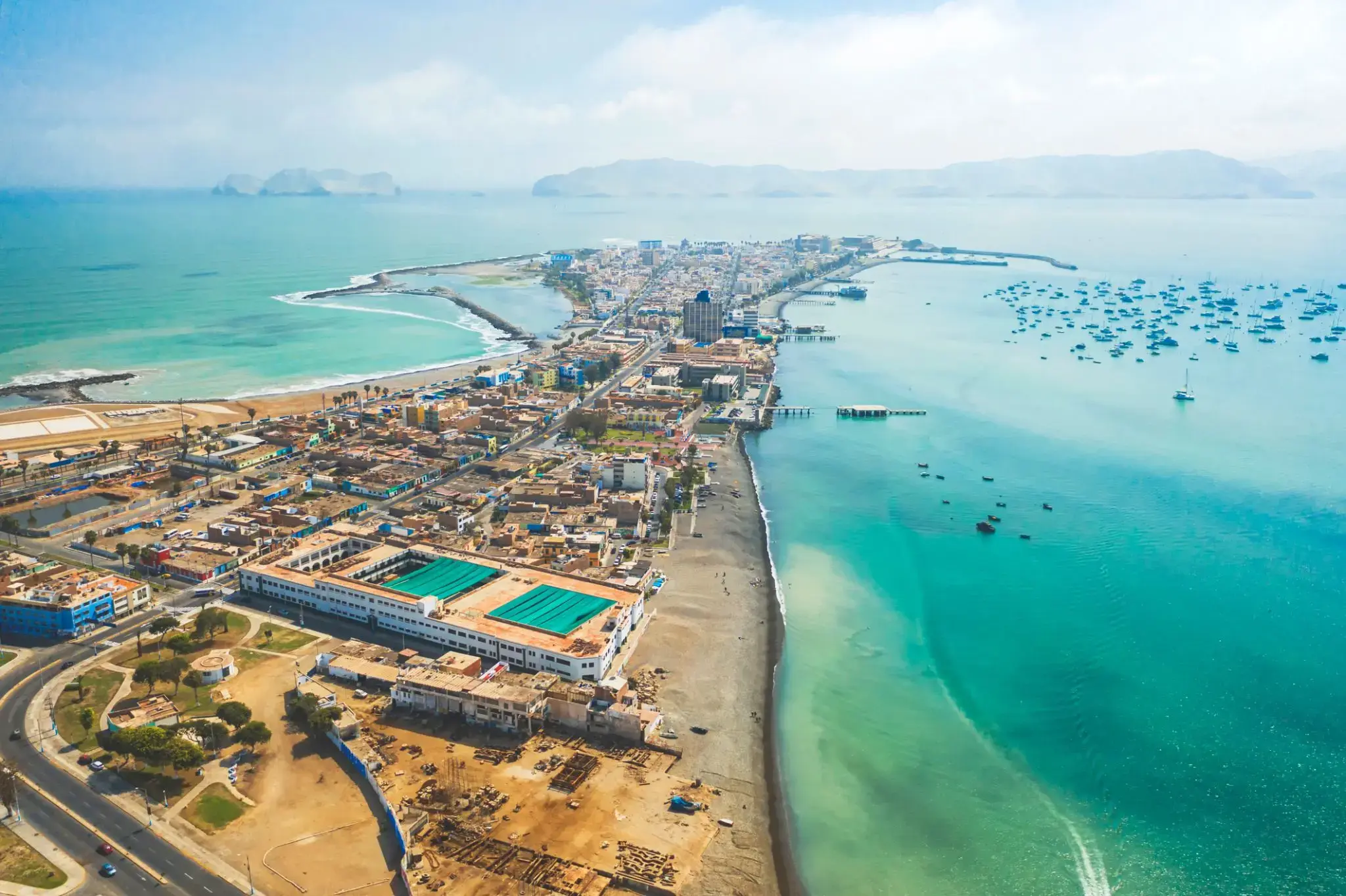
| 1 | 19.01 Wed | Callao / Peru | 17:00 | |
| 2 | 20.01 Thu | Day at sea / Sea | ||
| 3 | 21.01 Fri | Day at sea / Sea | ||
| 4 | 22.01 Sat | Day at sea / Sea | ||
| 5 | 23.01 Sun | Day at sea / Sea | ||
| 6 | 24.01 Mon | Day at sea / Sea | ||
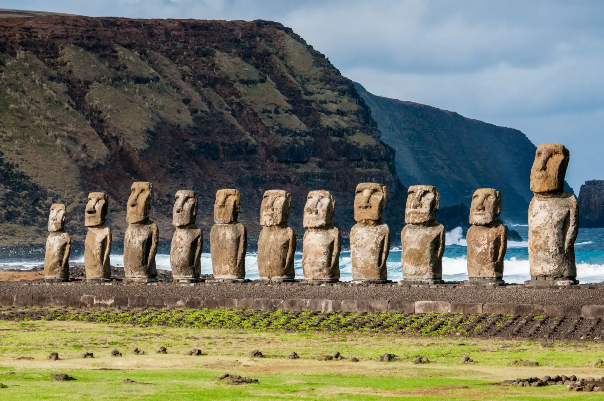
| 7 | 25.01 Tue | Easter Island / Chile | 08:00 | |
| 8 | 26.01 Wed | Easter Island / Chile | 13:00 | |
| 9 | 27.01 Thu | Day at sea / Sea | ||
| 10 | 28.01 Fri | Day at sea / Sea | ||
| 11 | 29.01 Sat | oh. Pitcairn | 09:00 | 17:00 |
| 12 | 30.01 Sun | Day at sea / Sea | 15:00 | |
| 13 | 31.01 Mon | Day at sea / Sea | ||
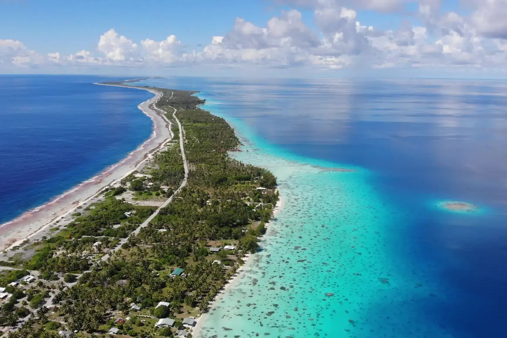
| 14 | 1.02 Tue | Fakarava / French Polynesia | 09:00 | 14:00 |
| 15 | 2.02 Wed | Moorea Islands Society / French Polynesia | 09:00 | |
| 16 | 3.02 Thu | Papeete / French Polynesia | 18:00 | |
| 17 | 4.02 Fri | Moorea Islands Society / French Polynesia | 15:30 | |
| 18 | 5.02 Sat | Papeete / French Polynesia | 09:00 |
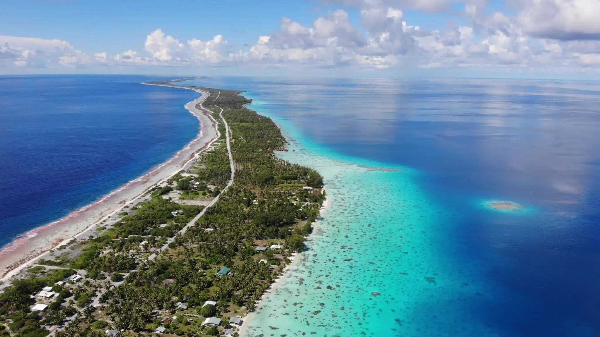
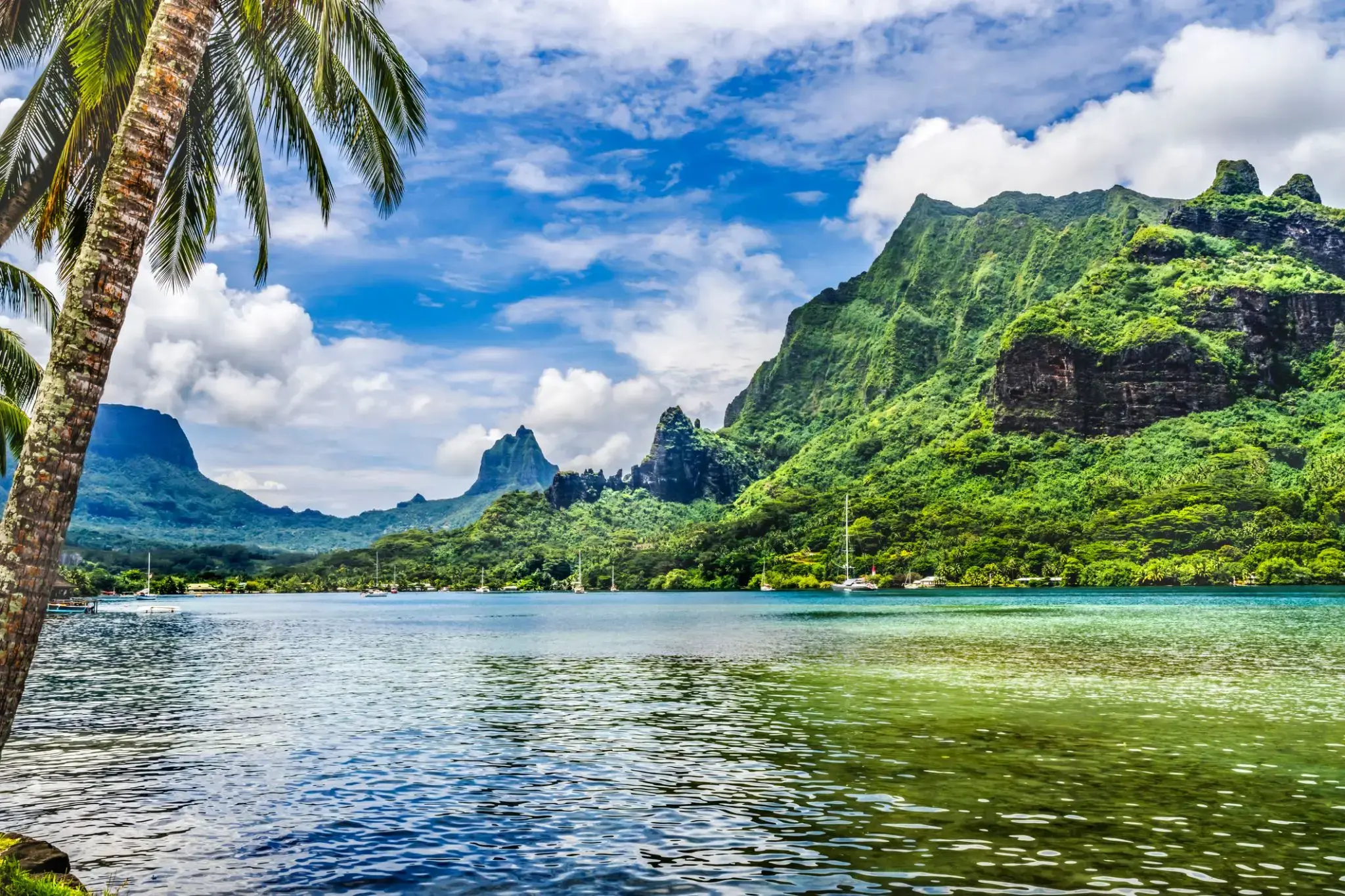
The island was formed as a volcano 1.5 to 2.5 million years ago, the result of a Society hotspot in the mantle under the oceanic plate that formed the whole of the Society Archipelago. It is theorized that the current bays were formerly river basins that filled during the Holocene searise.
Mo'orea is about 10 miles in width from the west to the east. There are two small, nearly symmetrical bays on the north shore. The one to the west is called 'Ōpūnohu Bay, which is not very populated but many travelers have come into the bay. The main surrounding communes of the bay are Piha'ena in the east and Papetō'ai to the west. The one to the east is Cook's Bay, also called Pao Pao Bay since the largest commune of Mo'orea is at the bottom of the bay. The other communes are Piha'ena to the west and busy Maharepa to the east. The highest point is Mount Tohi'e'a, near the center of Mo'orea. It dominates the vista from the two bays and can be seen from Tahiti. There are also hiking trails in the mountains. The Vai'are Bay is another small inlet, smaller than the two main bays, on the east shore. This bay has been settled a lot and has a lot of business. The main village is located just south of the bay.

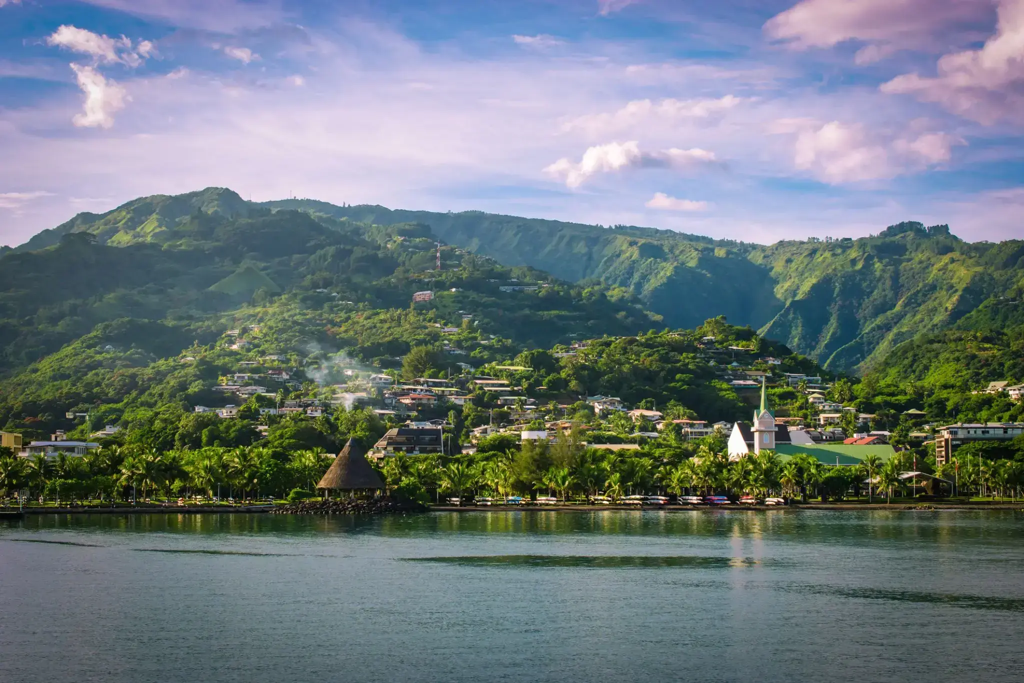
Papeete is the capital city of French Polynesia, an overseas collectivity of France in the Pacific Ocean. The commune of Papeete is located on the island of Tahiti, in the administrative subdivision of the Windward Islands, of which Papeete is the administrative capital. The French High Commissioner also resides in Papeete. It is the primary center of Tahitian and French Polynesian public and private governmental, commercial, industrial and financial services, the hub of French Polynesian tourism and a commonly used port of call. The Windward Islands are themselves part of the Society Islands. The name Papeete means "water from a basket".
The urban area of Papeete had a total population of 136,771 inhabitants at the August 2017 census, 26,926 of whom lived in the commune of Papeete proper.
The island was formed as a volcano 1.5 to 2.5 million years ago, the result of a Society hotspot in the mantle under the oceanic plate that formed the whole of the Society Archipelago. It is theorized that the current bays were formerly river basins that filled during the Holocene searise.
Mo'orea is about 10 miles in width from the west to the east. There are two small, nearly symmetrical bays on the north shore. The one to the west is called 'Ōpūnohu Bay, which is not very populated but many travelers have come into the bay. The main surrounding communes of the bay are Piha'ena in the east and Papetō'ai to the west. The one to the east is Cook's Bay, also called Pao Pao Bay since the largest commune of Mo'orea is at the bottom of the bay. The other communes are Piha'ena to the west and busy Maharepa to the east. The highest point is Mount Tohi'e'a, near the center of Mo'orea. It dominates the vista from the two bays and can be seen from Tahiti. There are also hiking trails in the mountains. The Vai'are Bay is another small inlet, smaller than the two main bays, on the east shore. This bay has been settled a lot and has a lot of business. The main village is located just south of the bay.
Papeete is the capital city of French Polynesia, an overseas collectivity of France in the Pacific Ocean. The commune of Papeete is located on the island of Tahiti, in the administrative subdivision of the Windward Islands, of which Papeete is the administrative capital. The French High Commissioner also resides in Papeete. It is the primary center of Tahitian and French Polynesian public and private governmental, commercial, industrial and financial services, the hub of French Polynesian tourism and a commonly used port of call. The Windward Islands are themselves part of the Society Islands. The name Papeete means "water from a basket".
The urban area of Papeete had a total population of 136,771 inhabitants at the August 2017 census, 26,926 of whom lived in the commune of Papeete proper.