| Company Category : Standard |
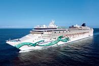
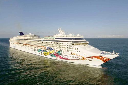
| Company name : Norwegian Cruise Lines |
| Ship name : Norwegian Jade |
| Journey Start Date : Sun 25 Feb 2024 |
| Journey End Date : Sun 10 Mar 2024 |
| Port start : Tampa / USA |
| Port end : Tampa / USA |
| Count Nights : 14 nights |
| Day | Port | Date | Arrival | Departure |
|---|---|---|---|---|
| 1 | Tampa / USA | Sun 25 Feb | 16:00 | |
| 2 | Key West / USA | Mon 26 Feb | 11:00 | 18:30 |
| 4 | Grand-Turk / Turks and Caicos | Wed 28 Feb | 08:00 | 17:00 |
| 5 | Puerto Plata / Dominican Republic | Thu 29 Feb | 07:00 | 16:00 |
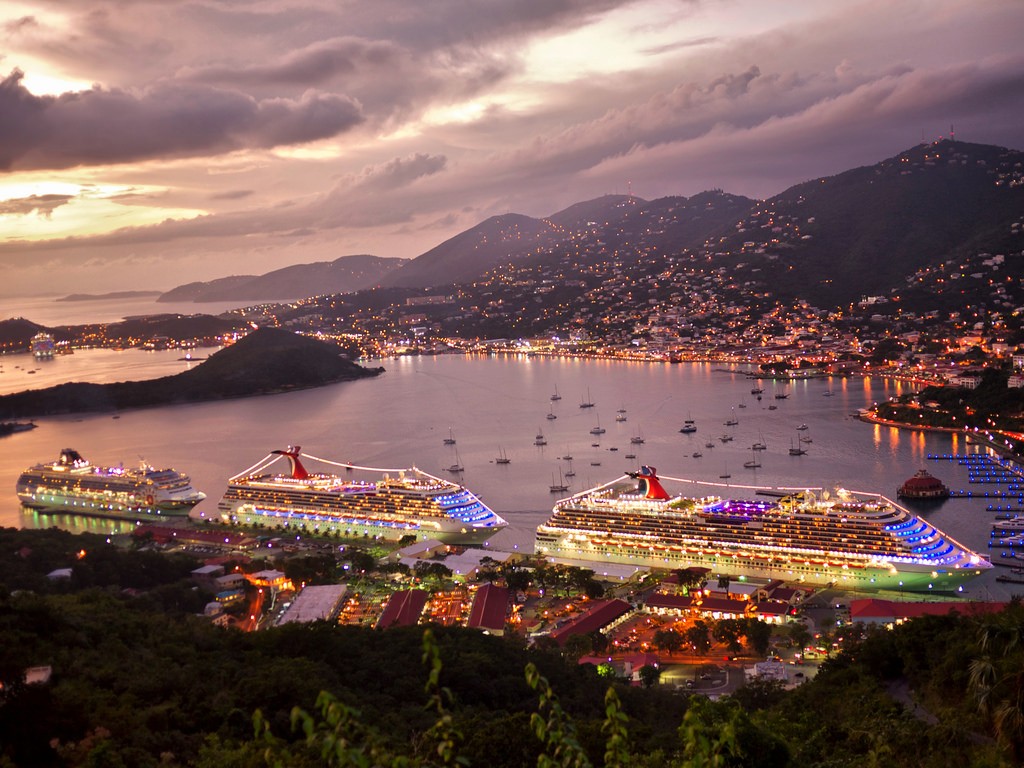
| 6 | Charlotte Amalie, Fr. Saint thomas / Virgin Islands | Fri 01 Mar | 11:00 | 19:00 |
| 7 | Antigua / Antigua and Barbuda | Sat 02 Mar | 07:00 | 17:00 |
| 7 | Antigua / Antigua and Barbuda | Sat 02 Mar | 07:00 | 16:00 |
| 8 | Bridgetown / Barbados | Sun 03 Mar | 07:00 | 17:00 |
| 8 | Bridgetown / Barbados | Sun 03 Mar | 09:00 | 18:00 |
| 9 | CRUISE SVARTISEN GLACIER / Norway | Mon 04 Mar | 06:00 | 14:00 |
| 10 | Willis Island / Australia | Tue 05 Mar | 12:00 | 21:00 |
| 11 | Aruba (Oranjestad) / Aruba | Wed 06 Mar | 06:30 | 16:00 |
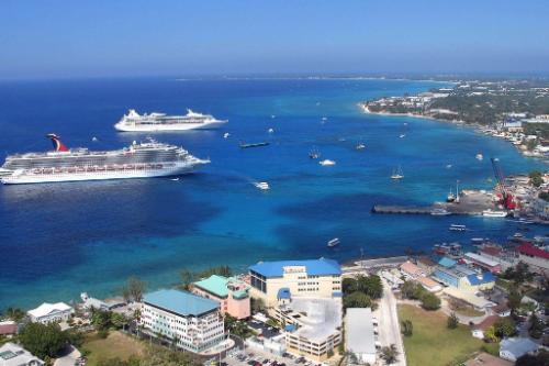
| 13 | Grand Cayman / Cayman Islands | Fri 08 Mar | 10:00 | 18:30 |
| 15 | Tampa / USA | Sun 10 Mar | 07:00 |
| Length : 294.00 |
| Speed : 25.00 |
| Capacity : 2224 |
| Deck Quantity : 12 |
Accommodation in a cabin of the selected category during the entire cruise (TV, telephone, shower/bath, hairdryer, air conditioning).
All-inclusive meals, excluding alcoholic beverages under the Freestyle program - free meal time.
Order food to your cabin 24 hours (additional charges apply for delivery between 00:00 and 05:00).
Set for making tea and coffee in the cabin.
Coffee, tea, water and iced tea during breakfast, lunch and dinner.
All entertainment on board (evening shows, nightclubs, live music, etc.).
Sports activities (table tennis, basketball, tennis and golf)
Participation of children in Children's clubs.
Fitness center, sports court, jogging track, swimming pools and jacuzzi.
Port fees, taxes and taxes.
For guests of Suite and Penthouse class cabins (in addition to all of the above):
Butler and concierge service.
Unpacking luggage on the day of check-in.
Champagne, liqueurs, fruits, bottled water and soda drinks (only for guests of Garden Villas and Owner`s Suites)
Champagne, bottled water and fruit on planting day.
Food delivery to the cabin 24 hours.
Minibar and Espresso/Cappuccino machine.
Pillow menu.
Bathrobe and slippers.
Priority check-in for the ship.
Escort to your cabin on check-in day.
Private transfer from port to airport (Garden Villas guests only).
Tips for staff (included in the bill and paid at the end of the cruise).
Casino, telephone, internet, video games.
Alcoholic and some non-alcoholic drinks.
Karaoke.
Bowling.
Laundry service.
Booking tables at alternative restaurants.
Registration of entry visas along the route.
Medical insurance.
Non-departure insurance (optional).
Air travel and transfers.
Excursions at ports of call.
Minibar in the cabin.
Personal services on board (SPA, beauty salon, laundry).
Key West is an island and city in the Straits of Florida on the North American continent. The city lies at the southernmost end of U.S. Route 1, the longest north-south road in the United States. Key West is the southernmost city in the contiguous United States and the westernmost island connected by highway in the Florida Keys. The island is about 4 miles (6.4 km) long and 1 mile (1.6 km) wide, with a total land mass of 4.2 square miles (11 km2). Duval Street, its main street, is 1.1 miles (1.8 km) in length in its 14-block-long crossing from the Gulf of Mexico to the Straits of Florida and the Atlantic Ocean. Key West is about 95 miles (153 km) north of Cuba at their closest points.
The city is the county seat of Monroe County. The city boundaries include the island of Key West and all or part of several nearby islands: Sigsbee Park, Fleming Key, Sunset Key, and the northern part of Stock Island. The total land area of the city is 5.6 square miles (14.5 km2). Key West is the southern terminus of U.S. Route 1, State Road A1A, the East Coast Greenway and, before 1935, the Florida East Coast Railway.
Key West is 129 miles (208 km) southwest of Miami by air, about 160 miles (260 km) by car, and 106 miles (171 km) north-northeast of Havana. Key West is a port of call for many passenger cruise ships. The Key West International Airport provides airline service. Naval Air Station Key West is an important year round training site for naval aviation due to the tropical weather, which is also the reason Key West was chosen as the Winter White House of President Harry S. Truman. The central business district is located along Duval Street and includes much of the northwestern corner of the island. The official city motto is "One Human Family."
Grand Turk Island is an island in the Turks and Caicos Islands. It is the largest island in the Turks Islands (the smaller of the two archipelagos that make up the island nation) with 18 km2 (6.9 sq mi). Grand Turk contains the territory's capital, Cockburn Town and the JAGS McCartney International Airport. The island is the administrative, historic, cultural and financial center of the territory, and has the second largest population of the islands at approximately 3,720 people.
Grand Turk was first colonised in 1681 by Bermudians, who set up the salt industry in the islands.[1] In 1766 it became the capital of the country. For some time, at least until the early 19th century, Grand Turk was often referred to as Grand Cay, not to be confused with either Grand Cay in the Bahamas or Grand Cayman.
The name comes from a species of cactus on the island, the Turk's Cap Cactus (Melocactus intortus), which has a distinctive cap, reminiscent of an Ottoman fez.
In 1962, John Glenn's Friendship 7 Mercury spacecraft landed in the vicinity of Grand Turk Island off the southeast shoreline. A replica of the Friendship 7 is on display in Grand Turk at the entrance to the Grand Turk Island airport.
Antigua is an island in the West Indies. It is one of the Leeward Islands in the Caribbean region and the main island of the country of Antigua and Barbuda. Antigua and Barbuda became an independent state within the Commonwealth of Nations on 1 November 1981.
Antigua means "ancient" in Spanish after an icon in Seville Cathedral, "Santa Maria de la Antigua" — St. Mary of the Old Cathedral. The name Waladli comes from the indigenous inhabitants and means approximately "our own". The island's circumference is roughly 87 km (54 mi) and its area 281 km2 (108 sq mi). Its populationwas 80,161 (at the 2011 Census). The economy is mainly reliant on tourism, with the agricultural sector serving the domestic market.
Over 32,000 people live in the capital city, St. John's. The capital is situated in the north-west and has a deep harbour which is able to accommodate large cruise ships. Other leading population settlements are All Saints (3,412) and Liberta(2,239), according to the 2001 census.
English Harbour on the south-eastern coast is famed for its protected shelter during violent storms. It is the site of a restored British colonial naval station called "Nelson's Dockyard" after Captain Horatio Nelson. Today English Harbour and the neighbouring village of Falmouth are known as a yachting and sailing destination and provisioning centre. During Antigua Sailing Week, at the end of April and beginning of May, an annual regatta brings a number of sailing vessels and sailors to the island to play sports.
On 6 September 2017, the Category 5 Hurricane Irma destroyed 90 percent of the buildings on the island of Barbuda. Residents were evacuated to Antigua.
Bridgetown is the capital and largest city of Barbados. Formerly The Town of Saint Michael, the Greater Bridgetown area is located within the parish of Saint Michael. Bridgetown is sometimes locally referred to as "The City", but the most common reference is simply "Town". As of 2014, its metropolitan population stands at roughly 110,000.
The Bridgetown port, found along Carlisle Bay (at 13.106°N 59.632°W) lies on the southwestern coast of the island. Parts of the Greater Bridgetown area (as roughly defined by the Ring Road Bypass or more commonly known as the ABC Highway), sit close to the borders of the neighbouring parishes Christ Church and St. James. The Grantley Adams International Airport for Barbados, is located 16 kilometres (10 mi) southeast of Bridgetown city centre, and has daily flights to major cities in the United Kingdom, United States, Canada and the Caribbean. There is no longer a local municipal government, but it is a constituency of the national Parliament. During the short-lived 1950s-1960s Federation of the British West Indian Territories, Bridgetown was one of three capital cities within the region being considered to be the Federal capital of region.
The present-day location of the city was established by English settlers in 1628; a previous settlement under the authority of Sir William Courten was at St. James Town. Bridgetown is a major West Indies tourist destination, and the city acts as an important financial, informatics, convention centre, and cruise ship port of call in the Caribbean region. On 25 June 2011, "Historic Bridgetown and its Garrison" was added as a World Heritage Site of UNESCO.
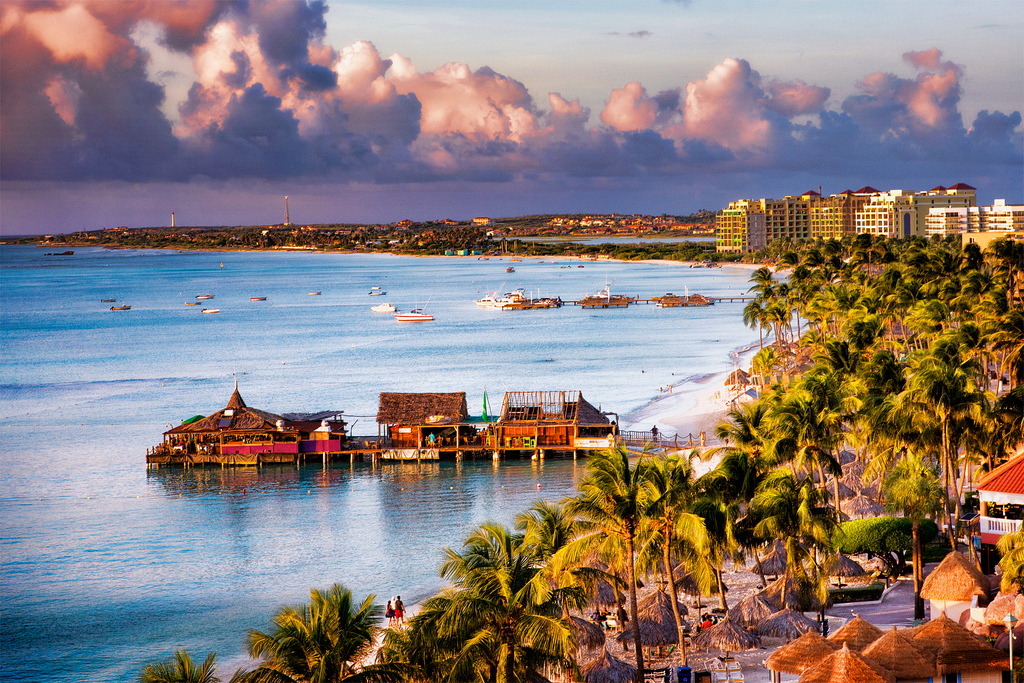
Aruba is an island and a constituent country of the Kingdom of the Netherlands in the southern Caribbean Sea, located about 1,600 kilometres (990 mi) west of the main part of the Lesser Antilles and 29 kilometres (18 mi) north of the coast of Venezuela. It measures 32 kilometres (20 mi) long from its northwestern to its southeastern end and 10 kilometres (6 mi) across at its widest point. Together with Bonaire and Curaçao, Aruba forms a group referred to as the ABC islands. Collectively, Aruba and the other Dutch islands in the Caribbean are often called the Dutch Caribbean.
Aruba is one of the four countries that form the Kingdom of the Netherlands, along with the Netherlands, Curaçao, and Sint Maarten; the citizens of these countries are all Dutch nationals. Aruba has no administrative subdivisions, but, for census purposes, is divided into eight regions. Its capital is Oranjestad.
Unlike much of the Caribbean region, Aruba has a dry climate and an arid, cactus-strewn landscape. This climate has helped tourism as visitors to the island can reliably expect warm, sunny weather. It has a land area of 179 km2(69.1 sq mi) and is densely populated, with a total of 102,484 inhabitants at the 2010 Census. It lies outside Hurricane Alley.
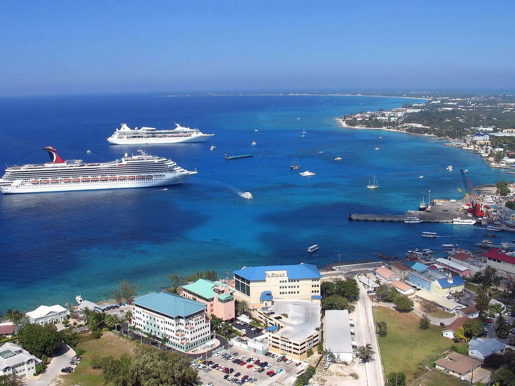
Гранд Кайман — самый большой из трех островов входящих в Каймановы острова, которые юридически относятся к Великобритании. Именно на Гранд Каймане расположилась столица — Джорджтаун. Сам по себе остров это риф, высота которого достигает 24 метров. Вода у побережья — удивительно прозрачная, это связано с тем, что на острове нет ни одной реки. Посетив остров, Вы получите возможность увидеть место, где выращивают зеленых морских черепах, эта ферма расположена в округе Уэст Бей. Каймановы острова прославились своей необыкновенной красотой подводного плавания. Но в полной мере понять красоту этого места можно лишь посетив его.